It all started with iPhoto '09 and "Places." If I was going to teach the application properly in my Lynda.com trainings and in iPhoto The Missing Manual, then I was going to have to get serious about geotagging.
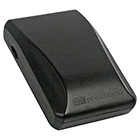
As I researched accessories for my Canon 5D Mark II and the Canon G9, I discovered that there wasn't really an affordable, convenient geotagging solution for these cameras. After much debate, I finally settled on trying the Jobo photoGPS Geo Tagging Flash Shoe device for $175. It is both Mac and PC compatible, and seems to allow a reasonable workflow for adding GPS data to my images, both Raw and Jpeg.
Once I get the device and fine tune the workflow, I'll report back here. In the meantime, if you have any tips, please post a comment.
-
Technorati Tags: Derrick Story, digital photography, Geotagging, Technology, The Digital Story













This looks good.
http://www.gisteq.com/PhotoTrackrLite.php
Today, literally hours before this post, I bought a GPS logger for this very reason. I'll be one of millions at President-elect Obama's inauguration next week. The uniqueness of Washington DC's architecture should make it easy to determine where any of my sure-to-be-thousands of photos where taken, I figure a GPS logger can only help. (Plus it wouldn't be such a big deal should I fail to be able to use it correctly.)
I decided against a hot-shoe mounting GPS because of two reasons. First, a separate data logger is about half the price of a shoe mount for my camera. Secondly, I think when I use it hiking, I may want a flash for fill. Additionally, the stand-alone GPS logger will allow my to trace my hikes when I get back.
Now the downside is the reliance on third-party software to compare timestamps and append latitude and longitude to EXIF data. Moreoever the particular device I bought is only Windows compatible, so I’ll have to extract the data in Windows and use some type of yet-to-be-found OS X program to merger my photos and the GPS data. Try figuring out how that is going to go indo your work flow!
This all stems from my recent conversion to the faith of tag-the-hell-out-of-everything. I seem to think that meta data is God and I need as much of it as I can. That’s why I shoot 14-bit RAW and tag everything. GPS is just more meta data. Who am I to say no?
My problem with Geotagging is the support for RAW formats. Most of these semi-automatic systems using 3rd part loggers and software that automatically tag you photos seem (from my research) to work well with jpeg photos coming out of the camera or card but I don't know anything that does Nikon Raw files.
I shoot RAW on my Nikon DSLR and use Lightroom to manage and process my photos. I would be interested in knowing the best workflow for getting location data into my RAW files. There seems to be a lot of different opinions out there and 3rd party plugins for Lightroom, anyone have a simple solution?
It's too bad the 5D and other Canon dSLRs can't just be plugged directly into a GPS unit. I heard the high-end Nikon bodies will talk to a Magellan. I've got a nice Garmin hand-held unit ( which I mostly use for hiking, cycling, and kayaking, but also take along when I do outdoor photography ) that I use in a similar after-the-fact manner. And while it would be virtually impossible to see the difference on the map, the purist in me is a little put off by the fact that there's some data loss in geotagging photos from a track log, as opposed to querying for lat/lon data in real time when the exposure is made.