The Eye-Fi Explore provides a geotagging alternative that doesn't depend on GPS. Instead, it taps the Skyhook Wireless database that contains thousands of WiFi hotspots and their location data. These hotspots have been surveyed by Skyhook and are constantly updated by users.
The Eye-Fi Explore Workflow
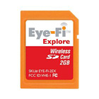
The Eye-Fi Explore system is straightforward. You insert the SD card into your camera's memory slot. It provides you with 2 GBs of storage plus WiFi connectivity. You use the Eye-Fi Manager software to set everything up. When you configure the card, you make it aware of your home network. That way it can automatically access it (even if it's password protected) and upload images as they are captured. During this process, Eye-Fi consults the Skyhook database, retrieves the geodata, then adds that information to the Jpegs it is transferring.
I have the card set up to transfer files to both my MacBook and to my Flickr account. The images that go to Flickr are kept private until I approve them for public viewing. Both versions of the image contain geodata that can pinpoint where I took the shot on a map.
I tested the Eye-Fi Explore card at my studio using a Canon G9 in Raw+Jpeg mode. When I took a picture, the Jpeg version was uploaded wirelessly to my MacBook and to Flickr. The Raw version of the image was left alone. To verify this process, I took the card out of the camera, inserted it into the Eye-Fi card reader, and looked at it on my computer. Both the Raw and Jpeg versions were on the SD card, and neither were tagged with geodata.
So, if you want to location data added, keep in mind that you can only do so if you use the wireless upload, and that it only affects the Jpegs. Raw files are not part of this workflow.
A Few Quirks
Hang on to the card reader that comes with the Eye-Fi Explore. For some reason the Eye-Fi card wasn't recognized by my regular card reader, so I'm now using its bundled mate instead.
Concerning accuracy of the geodata... that depends a lot on the accuracy of the Skyhook database. I noticed that the images shot at my studio were mistagged. The location was about a block away. The reason for this is that I had moved during the summer, and Skyhook still had the location for my AirPort Extreme at the old studio. So I went to the Skyhook Submit WiFi AP page and updated the database. I'm still waiting for update confirmation, even though I submitted the information a week ago.
And finally, you don't really have any control over the upload process. What you shoot gets uploaded and that's that. So for a lot of people, this process might not be a good fit.
The Bottom Line
The Eye-Fi Explore is selling for $105 on Amazon. It works as advertised, and it is a reasonable geotagging solution for urban settings and other areas that have WiFi access points. If the Skyhook database is accurate, so will be your geodata. You can shoot Raw+Jpeg with the card, have your Jpegs tagged and uploaded, then deal with your Raws later using your normal workflow.
Shooting around my studio, I liked the card. In my next installment, I'll take it out into the field and see how it works with Wayport hotspots.
See My Other Posts on Geotagging
Geotagging a Journey with photoGPS, iPhoto, and Flickr
iPhoto '09 as Your Geotagging Tool?
First Look at Jobo photoGPS Device and Software
Update to Geotagging Workflow, Including Jobo photoGPS
Finding a Reasonable Geotagging Workflow
-
Technorati Tags: digital photography, geotagging, Technology, The Digital Story, Eye-Fi Explore


Epic! I found your blog on Ask poking around for something totally unrelated, now I'm gonna need to read through all the old material :) So long my free time today, but this was a really spectacular find :D