Now that there's a Mac version of the Jobo photoGPS software, I could streamline my workflow for geotagging a journey home from a business trip. As I left the last meeting of the day at Lynda.com, I mounted the Jobo photoGPS Geo Tagging Flash Shoe on my Canon 5D Mark ll and documented my departure. I snapped pictures all along the way. It was a car-plane-bus-car trip making it perfect for documenting.
Once I returned home, I had the photoGPS write the geodata directly to the Jpegs on my memory card via the photoGPS software and my card reader, then I launched iPhoto '09 and imported the images off the card and into the application. This two-step process actually went faster than I anticipated. I chose the images I liked, put them in an iPhoto album, then uploaded directly from iPhoto to Flickr.
In order for your geodata to travel with your images into Flickr, you have to set the permissions in your Flickr preferences. Go to Your Account > Privacy & Permissions > Import EXIF location data (yes). Do this before you upload your images from iPhoto. Also in iPhoto, you can add descriptions for each image, and those captions will travel with the photos in to Flickr.
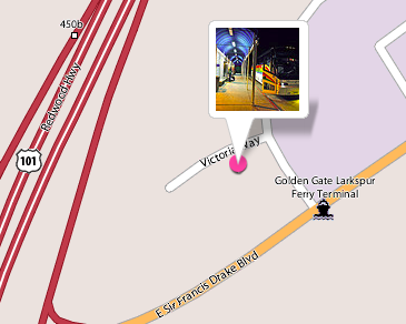
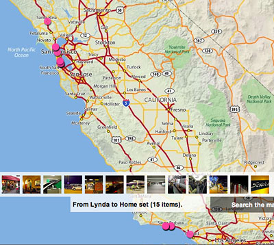
In my case, I told the story of a business trip home. You can see it by visiting From Lynda to Home. As you click from image to image, you learn about each stop along the way. If you click on the map link for each photo, you can see the location where it was taken. You can also click on the map link for the set to see all of the pins for the entire journey.

By clicking on the detail link for the set, you're presented with medium thumbnails for the trip with captions and map links. Flickr provides you with many different views and lots of information. It's really quite useful.
I'm going to keep playing around with this particular workflow. But I thought you'd like to see what can be done, even at the early stages. If you don't have a geotagging device such as the photoGPS, you can add the geodata in iPhoto '09, then upload to Flickr. You don't get as much geodata that way, but it's still a great option.
See My Other Posts on Geotagging
iPhoto '09 as Your Geotagging Tool?
First Look at Jobo photoGPS Device and Software
Update to Geotagging Workflow, Including Jobo photoGPS
Finding a Reasonable Geotagging Workflow
-
Technorati Tags: Derrick Story, digital photography, geotagging, iPhoto '09


Sounds like it works well.
This method should also work with aperture and maperture pro etc etc since it applies the geodata before import (this seems to be an issue with maperture pro for me if I geotag based on tracks after import the data is present but goes missing at export to file/flickr/others).
Looking at the pics you took and their placement were you satisfied with the accuracy? I guess I'm asking because when working from standard GPS tracks and timestamps - shots can be tagged by interpolating between the two nearest track points. If the Jobo has a poor satellite fix as you take the shot I wonder how it handles this.
Actually, I don't think this workflow would work with Maperture because it doesn't export the geodata out of Aperture. That's my big complaint with the plug-in.
As for GPS accuracy of the Jobo... depends on what your needs are. For general photography it's not difficult to clean up the data for an image or two in iPhoto '09. I didn't do that here because I wanted to present the results right out of the can. It all depends on what you need. When the Jobo has a hard time getting a fix, it seems to use the previous coordinates. You have to keep an eye on that.
Are you sure that GPS data that is applied to the EXIF prior to import to aperture fails to export?
I know that data applied with Maperture fails - but I thought I had it working with GPS data applied to the photo before aperture saw it. I'll have to test again (was testing with HoudahGeo and GPS Photo Linker)
What I suspect is happening there is that aperture exports EXIF from the master and IPTC from the version when you export a version - despite showing the EXIF from the version. This because it sees EXIF as immutable (and that is why maperture is not applying it to the master). However - if the data is pressed into the EXIF after taking the shot to the machine but before import - Aperture should work with it and include it in exports. And maperture plugin should show it too.
I think you're right Chris, that any geodata applied to the EXIF *before* Maperture sees it, persists. Good point. It's the geodata that Maperture applies that's been giving me fits.
Oh - me too, me too ;)
I was talking to the dev's about it in a bug report around new years - so I hope that they will deliver a solution. Until then - I geocode prior to import.
Good post, Derrick.
Your workflow is not that different from mine (other readers see URL on comment). I'm leery of letting something other than the camera write to my memory card, but I'm sure that's just my personal bias. I suppose I could do that should I ever change my workflow away from Bridge (or I could stage photos to my hard drive before importing). I was also pleased to discover since I wrote my piece on this subject that my solution works just fine with RAW files from my Rebel XSi.
How do you synchronize the clocks between the camera and gps? Or don't you (and pray)? I suppose setting your camera by a network-sync'd cell phone would get you pretty close.
I am going on a three-week trip to Europe this summer and was wondering how easy it would be to get the geotag data off to the photogps without having my laptop around. Can I plug in the photogps to a relative's PC without the photogps software installed, get the raw geotag data, and save the data to the cloud (dropbox or mobileme)? I will definitely take more than 1000 images and will need to clear out the photogps's memory.
@Nikolaus
I have not managed to access the photoGPS without the photoGPS software. The only way I know to get the data without using the photoGPS software is to use the all too expensive JOBO GIGA Vu extreme image storage device.
I wanted so badly to subscribe to your RSS feed but your RSS seems mess up and I can't read properly into it, I'm really frustated but if you could help me on this I'll appreciate it heartly.
To commercialise in terms of high-performance rather than monetary value, and in order to differentiate consequently, you necessitate to watch the ordinary format of the 4 Ps marketing plan. That is, Price, Product, Place and Promotion obviously you know the strong properties of the merchandise, and the price, but for place you should consider nearly the type of mass who are willing to give over 4x price of competing merchandise whereas the cheap option may be sold where emphasis is on cost, your product will be suited to places/distributors where the clients will be willing to pay for high-performance. Thank you for this article! I've just discovered a certainly big archive about how to get rich Judge it!
Kudos for posting such a useful weblog. this blog happens to be not just useful but also very creative too. We find a limited number of people who are capable of create technical articles that creatively. All of us keep searching for information regarding this topic. I Myself went through many websites to find knowledge regarding this.We look forward to much more !!
I appreciate you for maintaining such a terrific website. Your weblog was not just informative but also very stimulating too. We come across very few bloggers who can write not so easy articles that creatively. A lot of people are on the lookout for articles on this subject. We ourselves have gone through many websites to come across information with respect to this.Keep me informed when you write more on the subject !!